


Introduction
If you have purchased property, chances are that you will have been given a survey of the land as part of the purchase process. Most people think of surveys as maps showing the shape and boundaries of a parcel of land, but in truth, they can convey a great deal more helpful information! Surveys are an exact scale drawing of the dimensions of a parcel of land, also depicting the location and scale of physical structures such as homes or barns. However, they can also indicate natural features such as wetlands, streams and ponds, and topography such as ravines and hills. You can even get surveys that indicate the location and size of significant trees!
Importantly, surveys can also serve as a visual indicator of restrictions on land such as rights-of-way, setbacks, buffer zones, and easements, or things like encroachments on land by structures on neighboring properties like fences or buildings. All of these are essential things to be aware of when you purchase a property so that you know exactly what you’re buying and what you can and cannot do on the property! So, surveys can be a very important component of choosing an appropriate site for your animal sanctuary and ongoing planning of changes and improvements to the site. Read on to learn more about what kind of information you can get from a land survey and what kind of things you can ask a surveyor to map for you!
How Much Does A Survey Cost?
Costs are always an important consideration when it comes to anything to do with providing animal sanctuary! As mentioned above, a survey is typically done at the time of selling a particular piece of property. Typically, the buyer of the property at closing manages the survey cost, and the cost will vary depending on the size and complexity of the property in question. According to HomeAdvisor data, the typical range of a survey’s cost is from $375-745, with an average national cost of around $516. If you are getting a mortgage to help finance your purchase, you will typically need to get a more involved survey which will cost more. This is because lenders require that surveys precisely pinpoint property boundaries and locations of buildings on lots. These kinds of surveys will also generally draw attention to restrictions related to local regulations and possible neighbor encroachments.
In short, the cost of a survey will be highly dependent on the following:
- The complexity of its boundaries;
- The complexity of its natural features;
- The complexity of legal regulations such as zoning;
- And the complexity of a property’s legal history.
Note also that you can get surveys for specific purposes, like:
- Fence or monumentation surveys;
- Topographical surveys (these show the plane and grade of the land);
- Surveys associated with siting new construction;
- Maps of individual plots on your property;
- Location of utility lines;
- And even tree surveys to locate ecologically significant trees on your property!
Costs for these kinds of survey services can vary, but you can ask for them to be added on when you get a general survey done on your property. Many of these can be very useful to farmed animal sanctuariesAnimal sanctuaries that primarily care for rescued animals that were farmed by humans.! For example, knowing precisely where utility lines are located can help you avoid costly mistakes like digging in an area where there may be a gas or water line!
While the upfront costs of surveys may appear high, they can be well worth it when it comes to understanding precisely what you are purchasing, what you can and cannot do with your land, and identifying any potential issues with neighbors concerning encroachments and other issues. A good survey can resolve a lot of uncertainties and prevent a lot of headaches down the road!
How Do You Hire A Surveyor?
So how do you hire a surveyor? Most states will require that surveyors undergo professional licensing and carry insurance. You will want to ask for proof of those credentials when you interview surveyors and for proof of insurance. If you are working with a surveyor in conjunction with purchasing a property, you hopefully have engaged a qualified real estate attorney to help you oversee the purchase. Your attorney can also help you understand your zoning restrictions! Attorneys with local real estate experience are great people to ask for recommendations regarding surveyors.
The National Society of Professional Surveyors is a trade association of surveyors and has affiliated organizations in all fifty states. You can also contact them for recommendations in your area.
Another way to engage a surveyor is to look at the most recent survey of the property in question and contact the person who did that survey. They likely will have retained records about your property and may be able to update their survey at less expense than if you engaged a new surveyor. The validity of a survey depends on the period the professional surveyor’s liability lasts, which will vary by state. Your real estate lawyer should have insight into this question for you. During that duration of that time, a surveyor will defend their document against challenges such as, for example, litigation around encroachment by a neighboring fence or structure.
Typically this period is somewhere between five and ten years, but again, please consult with your legal professional on this question because some issues, like blatant new neighbor encroachments, will likely mean that you should conduct a whole new survey regardless of how old your survey is.
When you hire your surveyor, communicate clearly with them about your needs and plans for the property so that they can give you appropriate guidance on what kinds of services you may need from them and include all relevant information on the survey. For instance, your area may have restrictions on tree removal, so if your site planning may involve this, surveyors can identify relevant trees for you.
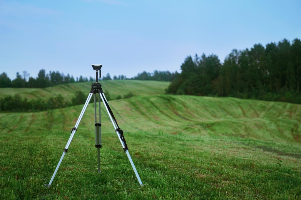
What Exactly Does A Surveyor Do, And How Long Does It Take?
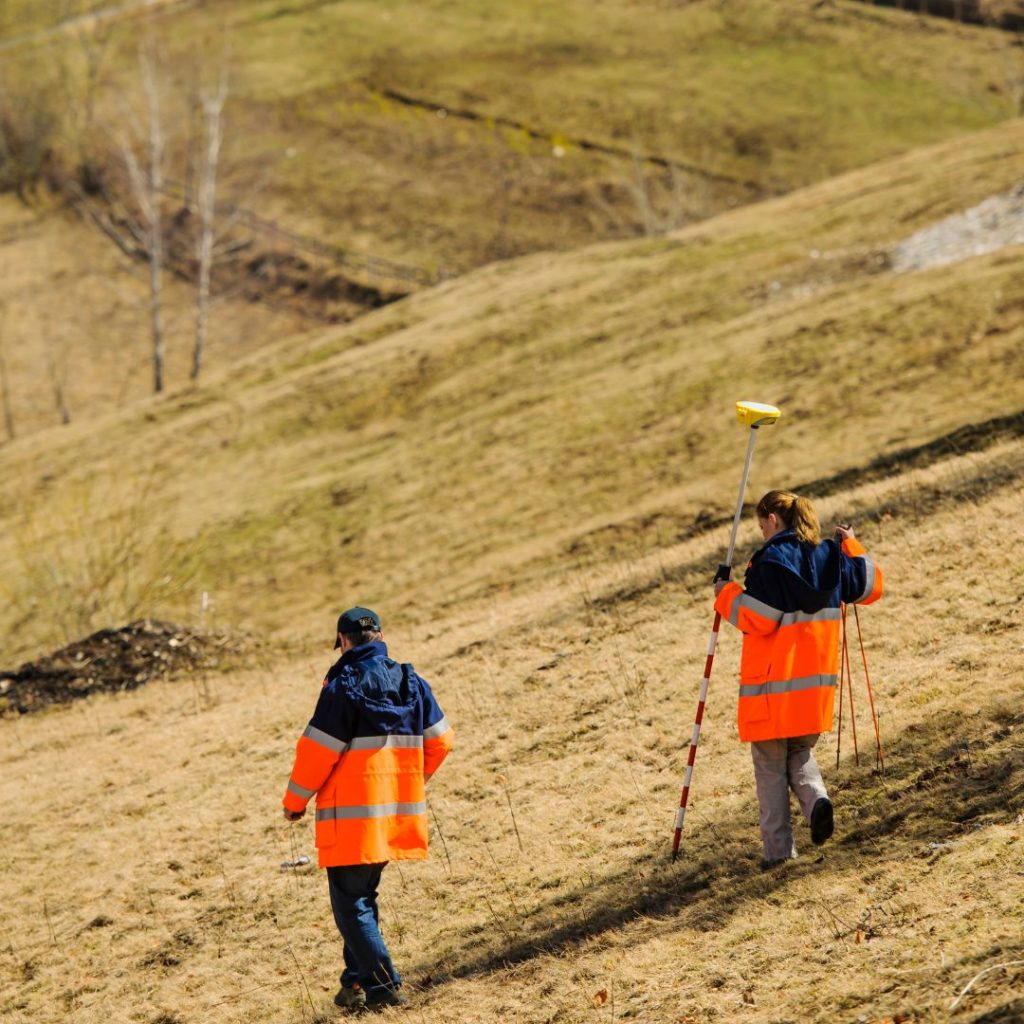
When you engage a surveyor, they will do a few different tasks. First, they will conduct research with local governmental bodies (typically, your county’s Recorder of Deeds and your municipality) to get past boundary information and records of any legal restrictions (like easements) on the property in question. This can take several days. However, the amount of time a surveyor may need to locate boundaries on the property physically can be variable, depending on how much fieldwork is involved.
This brings us to the second task of a surveyor! They will have to do some fieldwork. When most properties were plotted initially, this was done by placing “monuments” such as iron stakes or pieces of rebar along property lines. Your surveyor must attempt to locate these. This generally involves walking the property and using specialized equipment to locate past monuments marking corners and perimeter edges. Sometimes, however, properties may have been marked in less permanent ways or with natural monuments (like trees that may no longer exist). In this case, surveyors must do additional work to locate boundaries accurately.
Note also that fieldwork’s difficulty can depend on the season. Wooded areas can be more challenging to survey when foliage is full and thick, and wet areas may be harder to survey in wet seasons. Therefore, the amount of time a surveyor may need to do fieldwork can vary significantly. It is, however, essential to give them the time they need to do this work accurately, particularly if you are concerned about locating floodplains accurately, for example.
Third, a surveyor will have to compile all of the data they accumulated from their research from legal records and fieldwork and create a land survey map that shows all of this information. This can take them several days or longer, depending on how much information and detail you have requested from them.
What Will A Survey Tell You? And How Do You Read It?
Ultimately, at minimum, you will end up with a complete map of your property that should accurately show its boundaries, all structures (including fencing, homes, and other buildings), and any additional information you have requested from your surveyor. While most people think that surveys are primarily done to show the physical boundaries of a particular property, surveys can show so much more information that can be critically important to farmed animalA species or specific breed of animal that is raised by humans for the use of their bodies or what comes from their bodies. sanctuaries! Make sure to think about all of your future plans when you engage a surveyor so you get all the information you want about a property in advance of planning new construction or infrastructure!
When you get your survey, lay it out on a flat surface along with any written documentation (such as easement documents) that your surveyor may have provided. Your document should show:
- Your address, which should match the address shown on your property deed.
- A legend. Like a map, your surveyor will use unique symbols to indicate boundaries, utility lines, roads, natural features, and roads. The legend should help you identify these.
- A scale. This should indicate how measurements on the survey correspond to actual measurements.
- A legal description and written survey. The legal description is the geographical description of the property which identifies its precise location and should also be included on the deed of the land. The written survey should also list all relevant legal documents (including their document numbers as recorded by your local Recorder’s office) and any disparities between previous surveys and the current one, particularly any new encroachments noted.
- A sealed certificate: your survey should be signed and sealed by the surveyor.

Physical Boundaries
How the physical boundaries of your property are measured will depend on your surveyor’s methodology and the convention for measurement in your jurisdiction. Your survey’s legal description should describe, in words, the physical boundaries of your property. In many jurisdictions, metes and bounds legal descriptions are considered to be the most accurate way of describing the boundaries of a parcel of land.
In reading a metes and bounds legal description, you will see that it identifies a “point of beginning,” which then traces the outline of the property’s boundary lines, noting potentially both natural monuments and artificially placed monuments (like stakes, rivers, roads, and trees) that are found along boundary lines. It will trace the outline of the boundaries until it closes with “the place of beginning.”
In most modern surveys, distance is often measured in land survey rods. A rod is equal to 5 ½ yards, 16 ½ feet, 1/320 of a statute mile, or 5.0292 meters. Rods are an effective unit of measurement because the whole number multiplies easily to form an acre of square measure. For example, one acre is 160 square rods, or a rectangular area bounded by sides measuring 40 rods and 4 rods. Check out this resource for examples of what different legal descriptions might look like!
Natural Features
Depending on how much detail and work you have requested from your surveyor, your survey may show you a lot of important information on the natural features of your property! Some of the most significant natural features that could impact your animal sanctuary are wetland areas and floodplains, as well as any possible buffer zones associated with them.
You may want your surveyor to identify wetland and floodplain areas for many reasons. Of course, resident well-being is high among them! You probably will not want to locate particular residents in areas that are likely to stay wet and mucky, both out of consideration for general safety should floods occur, the residents’ needs for safe footing, and also perhaps to avoid unwanted exposure to flies, mosquitos and other insects that like these kinds of areas. If you know in advance what areas of your property are prone to flooding, you can avoid making costly siting mistakes for infrastructure like pastures and housing for particular residents who may not appreciate it. Remember, when making plans for your sanctuary site, it’s always a good idea to center your residents’ safety, needs, and desires first! For more on this subject, check out our resource on animal-centered design here!
Keep in mind as well that if you are near such areas (or bodies of water generally), it’s good to plan around them when it comes to waste disposal practices like composting. The federal Water Pollution and Prevention statute, commonly known as the Clean Water Act, can have implications for any kind of operation that impacts bodies of water, even if they are minimal. This means undertaking waste disposal responsibly and legally. Keeping your organizational operations green is important to providing sanctuary responsibly!
Legal Restrictions
Your survey is not just a simple map. It can also teach you many different things about the legal rights and restrictions associated with your property. It’s very common for property owners to assume that once they have purchased a piece of property, they can do whatever they like! But this is far from the truth. You may have to deal with several legal restrictions that a good survey can help you learn about. Remember that the kinds of restrictions you may have to deal with are not restricted to the kinds of issues that a surveyor can alert you to!
In understanding these kinds of legal restrictions on your land, it’s helpful to consider the metaphor of property as “a bundle of sticks.” Each stick in the bundle represents a particular set of rights that you have in the land. For example, one stick in the bundle might be the right to draw water freely. Believe it or not, in many areas, there can be restrictions on how and when you use water! Another example is building rights. On some pieces of land, you may be legally restricted on how and where you build structures. It’s always important to consult with a qualified attorney in your jurisdiction who can help you navigate these issues! Some of the issues that you may encounter can include the following:
- Setbacks
- Buffers
- Easements
- Rights Of Way
- Mineral/Riparian Rights Issues
What’s A Setback?
Simply put, a property setback is a building restriction (generally created by zoning laws) that is imposed on landowners. The goal of setbacks is to make sure that neighbors and communities build in a manner that allows them all space and comfort. Imagine if your house was directly next to the house next door and directly abutted the house behind. This would restrict everyone’s access to space, light, and ventilation and create an unpleasant living situation for everyone! Further, it could cause problems requiring emergency response, like fires. Setbacks create space between buildings and lot lines to prevent these types of issues. Setbacks may also apply to other kinds of scenarios. For example, if you live in a municipality that allows you to keep chickens, you may have a setback restriction on where you keep your coop and run, which requires you to keep it a certain distance from your neighbor’s lot line or house. A survey can graphically show the setback area to which you are required to conform, which can be very helpful in planning buildings and other uses!
What’s A Buffer?
A buffer is similar to a setback, except it is a term that is usually used regarding environmental features on your property. For example, a wetland on your property may not be the only ground that is limited in terms of development. It may have an associated “buffer zone” in which your development rights may be restricted to preserve the environmental integrity of the wetland. Buffer zones may be prescribed by federal or local law, and surveys can help you visualize how they can impact your property use.
What’s An Easement?
There are many different easements, but in essence, an easement gives another entity (whether it be another individual, a company, or a government entity) the right to use your property. It does not give them an ownership interest, but rather, passes to them one of the sticks from the “bundle of sticks” that make up your property rights. A typical example of an easement is a utility easement. A utility easement gives the right to a utility company to access and maintain utilities, such as electrical, water, or gas infrastructure that may be located on your land.
It’s important to remember that legal documents may form some easements, and other easements may not be apparent in your property’s formal legal history but may still exist. A qualified surveyor who is informed about the history of your property and area should be able to give you notice of any easements that may exist on your property!
Keep in mind that your property may also have easements over other properties. When you purchase a property, your attorney and surveyor should be able to inform you if you have any kinds of easements over neighboring properties that may benefit you!
In all cases, it’s very helpful to be aware of easements that may exist on your property. For instance, it would be pretty unfortunate to build a new barn only to find in coming years that it encroaches on a utility easement when a gas line requires maintenance, and you are then compelled to tear it down to allow access!
What Are Rights-Of-Way?
A right-of-way is like an easement, but it is both more specific and more general simultaneously. A right-of-way gives other parties (not just specific ones) the specific (and limited) right to travel across your property. An example is if you have a public sidewalk that crosses the front of your property. Depending on your municipality, you may or may not be required to maintain rights-of-way for accessibility – for example, shoveling sidewalks in winter so the public can safely access and use them. These are important to be aware of because how you maintain rights-of-way can potentially cause liability issues for your organization.
What Are Mineral And Riparian Rights?
In the United States, mineral rights to a property can be separated from “the bundle of sticks” that make up property ownership rights. This means that a previous property owner may have sold the right to excavate or drill for mineral or other subsurface natural resources to another party, and this conveyance may not be immediately apparent from your deed. In areas of the country where mineral and oil exploration is common, this kind of separation of “the bundle of sticks” is common and can be an unpleasant surprise for landowners! Your attorney and surveyor should be able to research this for you to be aware of any separation of mineral rights ownership on your property.
Riparian rights relate to the legal rights of owners who border on bodies of water. If you own land with a body, your “riparian rights” to that water are what determine your rights of access to that water for drinking, bathing, or irrigation purposes. Again, your attorney and surveyor should be able to give you a clear idea of what your rights are in these regards.
Conclusion
Knowing your exact land rights is critical when you own or use a property for sanctuary purposes. An attorney can give you detailed information on your rights and restrictions regarding your land use, as can a surveyor. A surveyor can be uniquely valuable when it comes to site planning because they can provide you with a visual guide of not just property boundaries and building footprints, but also the natural features that characterize your property and legal restrictions that might otherwise go unnoticed. So, hiring a surveyor with an eye to your future sanctuary plans can be an incredibly useful thing to do for your farmed animal sanctuaryAn animal sanctuary that primarily cares for rescued animals that were farmed by humans.
SOURCES:
Choosing A Site For Your Animal Sanctuary | The Open Sanctuary Project
Understanding Your Animal Sanctuary’s Zoning Rights And Restrictions | The Open Sanctuary Project
Breaking The Mold: How Animal-Centered Design Can Transform Sanctuaries | The Open Sanctuary Project
Composting 101: The Scoop On Poop | The Open Sanctuary Project
Introduction To Manure Management For Farmed Animal Sanctuaries | The Open Sanctuary Project
Going Green: Your Animal Sanctuary And The Environment | The Open Sanctuary Project
Land Survey: What It Is, Types, And Costs | Rocket Mortgage
How Much Does A Land Survey Cost? | Home Advisor
What Is A Property Survey, And How Do I Get One? | Bankrate
National Society Of Professional Surveyors
Survey Methods For Accurate Distance Measuring | Baseline Equipment Company
Metes And Bounds | Legal Information Institute: Cornell Law School
Legal Descriptions: Sample Clauses | Law Insiders
GIS (Geographic Information System) | National Geographic
Property Setbacks: What Are They And Why Do They Matter? | LandCentral
Buffer Land Definition | Law Insider
What Is The Difference Between An Easement And A Right-Of-Way? | CourtHouseDirect


